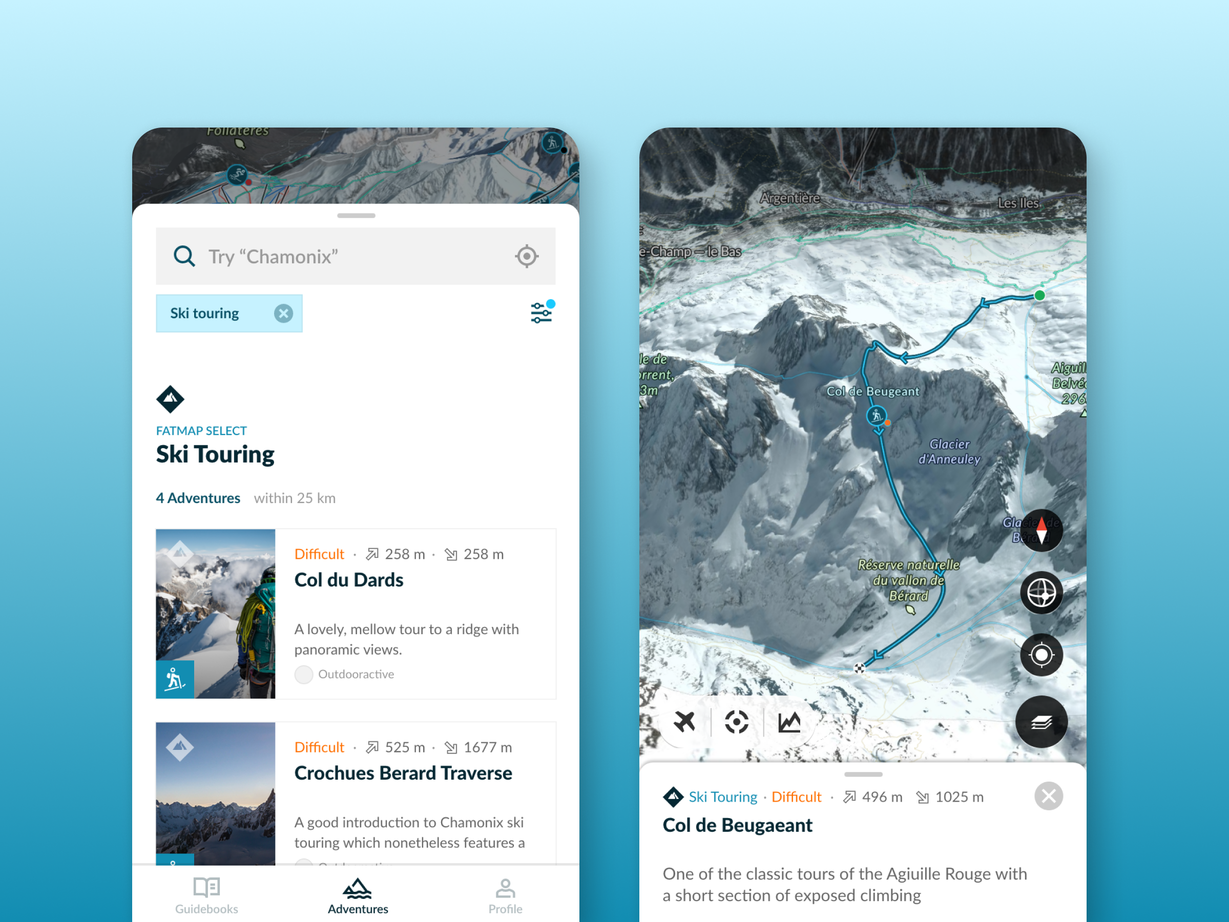
The brief was “let's build Google maps for the mountains”. The mission was to make extraordinary places and the potential for adventure in the outdoor more accessible.
“FATMAP has changed the way I see and act in the mountains”
– Xavier De Le Rue, The North Face Athlete
– Xavier De Le Rue, The North Face Athlete
Company: FATMAP by Strava
Date: 2013 – 2021
Contribution: Map design; colour schemes, typography, iconography, interaction behaviours, & data layers
Working within a small design team and collaboratively with data and engineering teams I was responsible for designing FATMAP's fat map, inspired by the renowned SwissTopo printed maps we aimed to bring that aesthetic and quality into the dynamic 3D digital landscape.
Finding balance
The ongoing effort was in finding contrast between the background (rock, snow, grass, water, sand…) and foreground information (routes, points and areas of interest). Fine-tuning where we emphasized or de-emphasized details to achieve a balanced legibility. We then needed to ensure the most relevant of that information surfaced for the user when they wanted it across zoom levels and distance from camera.
The road network was de-emphasized, there are an abundance of apps catering for driving directions. Our users needed to understand how the roads would intersect with their adventure and the satellite imagery was sufficient for that.
Paths and tracks were pulled forward and distinguished from each other, outdoor POIs were moved up the ranks in the information hierarchy - we wanted waterfalls, glaciers, streams, peaks, huts, and any relevant waypoint data on hand, ready for outdoor planning and navigating.
Map language key: area, line, points
Categories for adventures, styling within Mapbox Studio
As we gained more data the design system for adventures grew into 4 adventure categories ; Land, Snow, Water & Rock. Iconography was optimized for legibility, distinction and even showed correct human body posture (our icons wanted to be athletes) within the confines of 24x24 pixels.
The process involved working closely with data and 3D engineers to ensure data accuracy and technical feasibility in 3D. Design and specifications were produced across illustrator, XD and Mapbox Studio, alongside a custom viewer built by the engineering team that allowed design and testing within FATMAP's 3d engine.
Hiking adventure in focus (earlier colour-ways)
Ski touring adventure in focus
Lack of knowledge holds people back from exploring wild places. Outdoor information is localized and disparate. The map's job was to offer all the outdoor information a user needs to discover, plan and live adventures confidently; localized snow depth and lift status, hazards along a route, the best lunch spots, route variations, overarching terrain information such as elevation, avalanche and aspect.
A personal highlight was the aspect data layer, visualizing warmth and coolness through colours to align with users' outdoor experiences. The layer could give foresight to gauge sunlight or shade on slopes, enabling users to time their hikes for optimal shade during the hottest parts of the day, or ski tours with safest snow conditions. For the southern hemisphere this has to be flipped as the north-facing slopes receive more sunshine than south-facing slopes.
Specification for terrain layers colour-ways & components
Data layers: Gradient, Aspect, Avalanche, Elevation
Data layer: aspect slope
Outcome
FATMAP built a dedicated and loyal fan base with 1.6 million registered users. Strava acquired FATMAP in 2022 and is currently integrating FATMAP into its subscription services.
“Useful and inspiring (and also looks really really cool.)” - Forbes
"[FATMAP] may be the most ambitious adventure tech to hit the market since sat phones" - Outside Online
“An app that will revolutionise your backcountry freeriding experience” - Red Bull
